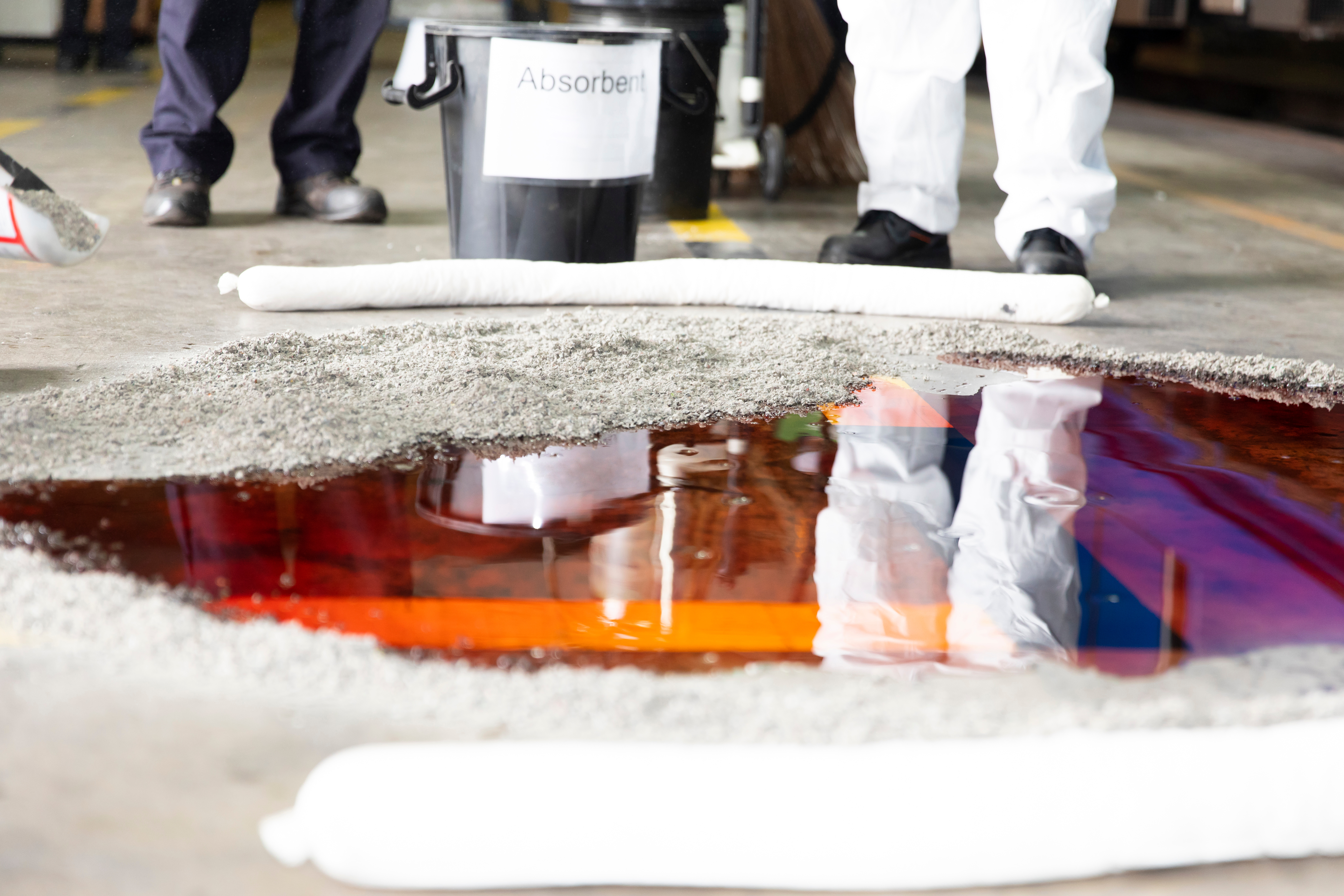
OceansMap

CHEMMAP

CHEMMAP is a chemical discharge modeling and response system that predicts the transport, fate, and biological impacts of a wide variety of chemical substances in the marine environment and atmosphere.


chemmap

Why CHEMMAP?

Chemical spills are complex. Their behavior depends on environmental conditions, chemical properties, and release scenarios. CHEMMAP brings all of these variables together into a single, integrated platform—allowing you to visualize outcomes, assess risk, and act with confidence.

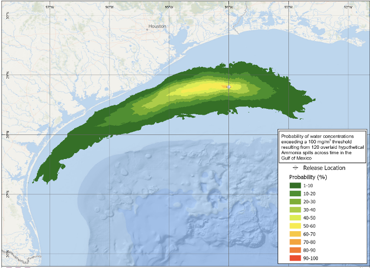
With CHEMMAP, you can:

  • Anticipate spill trajectories and impacts before they occur
  • Evaluate worst-case scenarios for contingency planning
  • Train teams using realistic, data-driven simulations
  • Support regulatory compliance and environmental assessments

What CHEMMAP Does

CHEMMAP simulates the full lifecycle of a chemical release—from initial discharge through transport, transformation, and eventual fate in the environment.

Its modeling capabilities include:

  • Movement and spreading of floating materials
  • Evaporation and volatilization into the atmosphere
  • Transport and dispersion in water and air
  • Dissolution, sediment interaction, and resuspension
  • Natural degradation processes
  • Shoreline interaction and contamination

The result is a detailed, time-varying picture of where contaminants go, how concentrations change, and what environmental receptors may be affected.

chemmap

Key Capabilities

Spill Response & Emergency Management


Forecast spill movement and concentrations to guide response actions

Contingency Planning


Model worst-case discharge scenarios and identify potential impacts

Environmental Impact Assessment


Evaluate point source discharges and potential exposure risks

Hindcasting & Analysis


Reconstruct past events to understand environmental outcomes

Built on Robust Data and Science

CHEMMAP integrates multiple datasets and scientific models to ensure accuracy and reliability:

  • Global Environmental Data - Includes currents, winds, temperature, salinity, bathymetry, and more
  • Extensive Chemical Database - Covers a wide range of hazardous and noxious substances (HNS), including acids and bases (e.g., caustic soda), petroleum hydrocarbons, ammonia, and floating materials such as plastic nurdles
  • Real-Time Data Integration - Seamless connection to environmental data services for live and historical conditions

This combination ensures simulations reflect real-world conditions as closely as possible.

chemmap

Powerful Visualization & Integration

CHEMMAP is designed to make complex modeling results easy to understand and act on:

  • GIS-based interface with optional integration into other GIS platforms
  • Clear, visual displays of concentration changes over time
  • 3D visualization capabilities for enhanced interpretation
  • Flexible use of hydrodynamic data formats

These tools allow both technical specialists and decision-makers to quickly interpret results and take action.

SARMAP drift tracks

Advanced Modeling Capabilities

Trajectory & Fate Modeling

Predict where chemicals will travel and how they will behave over time, with outputs that include:

  • Surface and dissolved concentrations
  • Volatilization and degradation rates
  • Sediment accumulation
  • Sensitivity to environmental factors like wind, currents, and release depth

Stochastic Modeling (Service-Based)

Go beyond single scenarios to understand uncertainty and risk:

  • Probability of exceeding environmental thresholds
  • Range of possible contamination outcomes
  • Statistical distributions of model results
SARMAP drift tracks

Contact Us